|
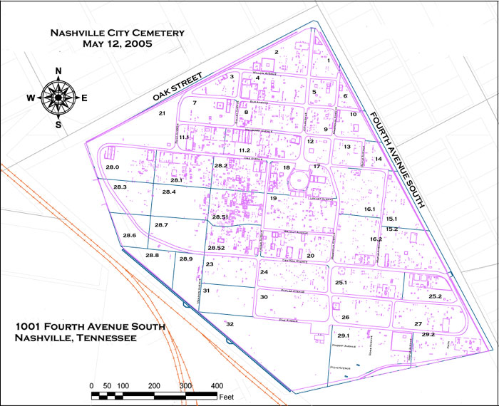
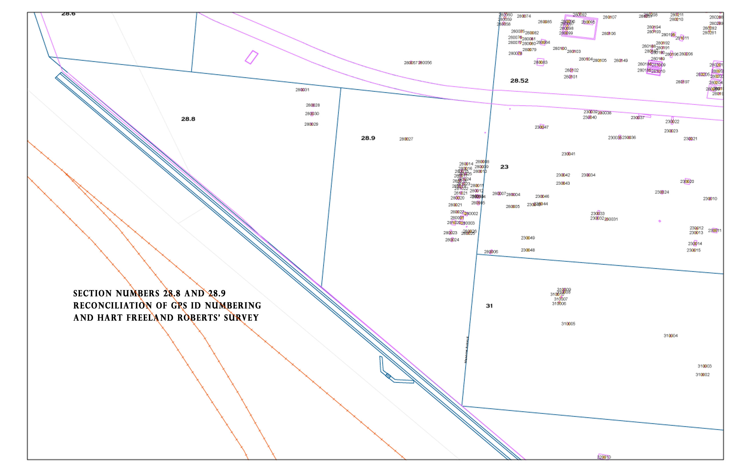
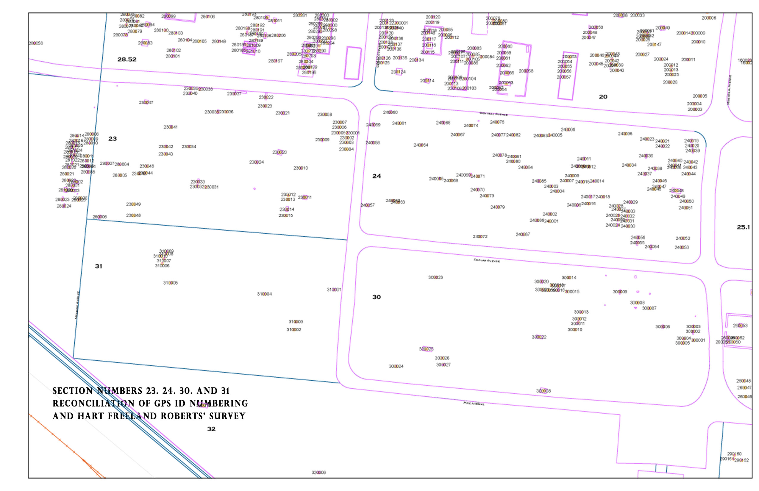
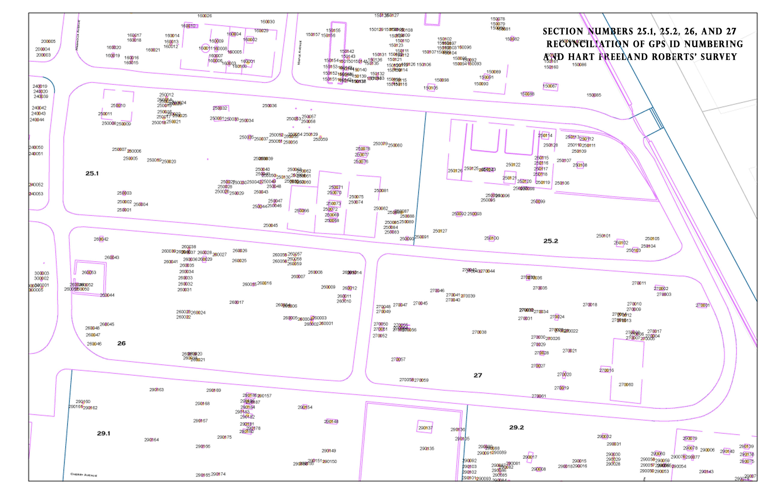
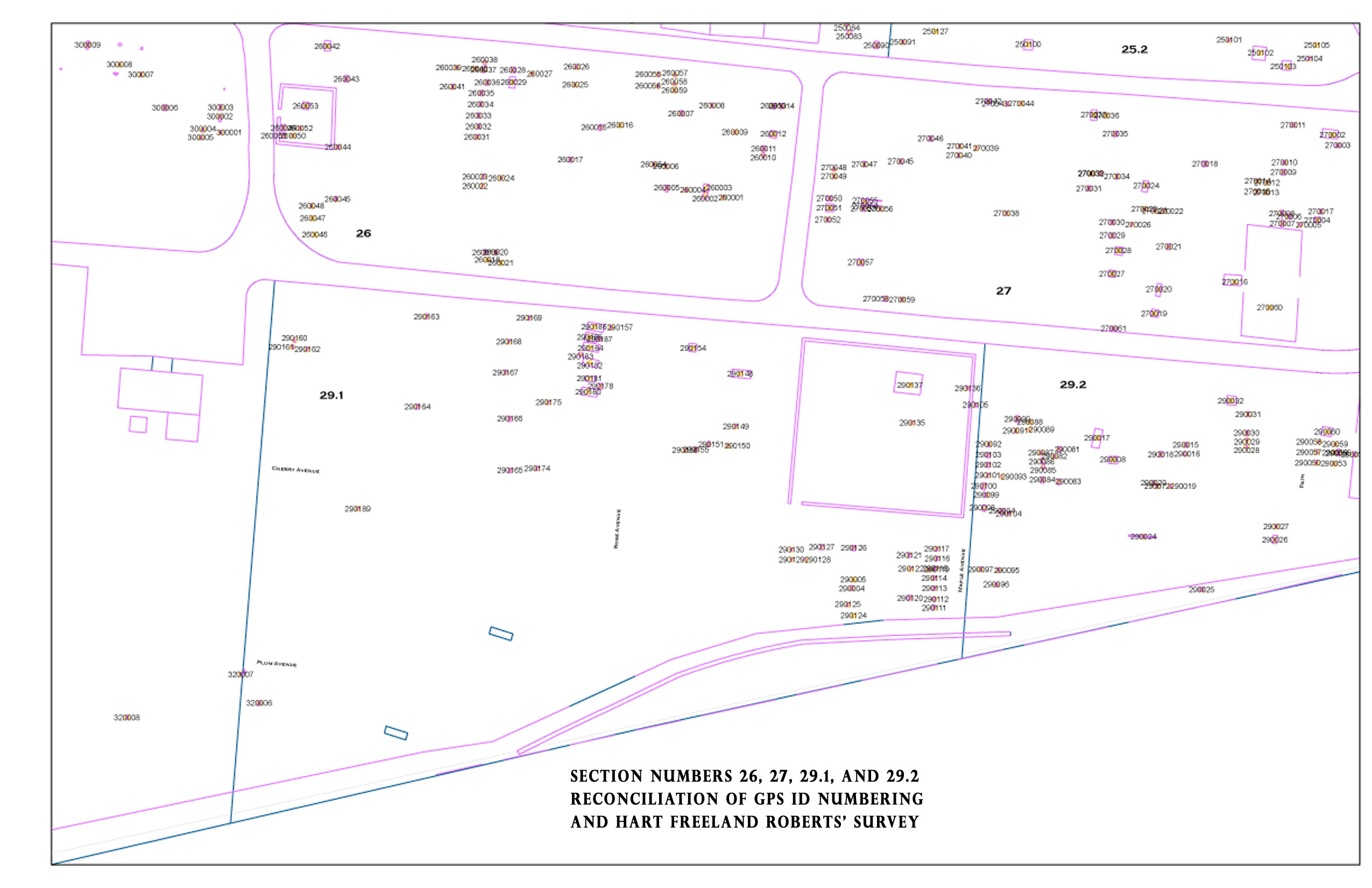
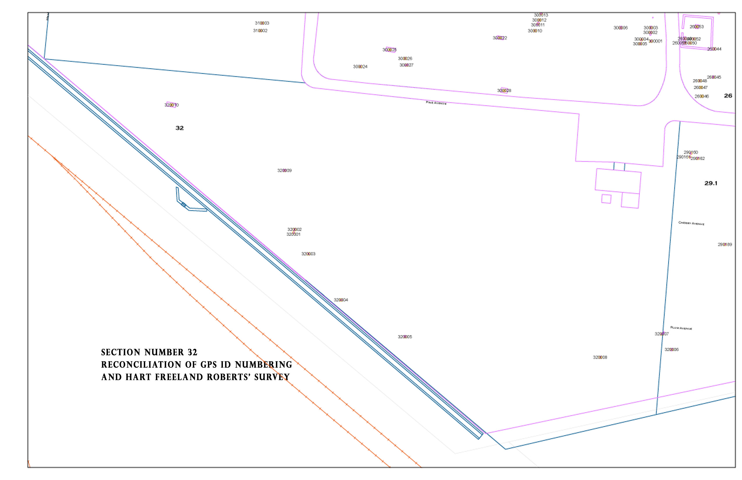
Click on an area of the above map to view that Section from the Metro Historical Commission image—combining ID mapping done by Middle Tennessee State University
with maps developed by HartFreeland Roberts for the Metro Historical Commission
When any of these images are opened, you will need to use your browsers’ method of
making the image actual size and then use the scroll bars to see all the
areas in a readable format.
Click here for an aerial map of the cemetery showing the section numbers and street names and here to see the marker designation overlay on the aerial view, again showing the street names and section numbers. | 
